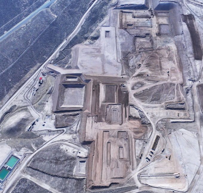
Data from the U.S. Geological Survey’s Landsat satellite program, managed in partnership with NASA, has helped shape the development of the Thacker Pass lithium project.

For more than 50 years, Landsat, the satellite program managed by the U.S. Geological Survey and NASA, has provided continuous Earth observation data to support science-based decision-making, including mine planning in sensitive environments.
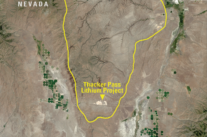
A recent example of this application is Lithium America’s Thacker Pass project in Nevada’s Humboldt County. USGS has reported that Landsat data was used to estimate groundwater depth and assess vegetation, two key factors in environmental impact assessments.
“Landsat imagery is valuable for critical minerals project development because it provides consistent, long-term data that document land use changes and geological features, assess environmental receptors and support planning decisions,” explained Alexi Zawadzki, president of North American operations and vice president of Resource Development for Lithium Americas. “Its resolution and multispectral data enable accurate analysis of vegetation, water resources, and terrain features, aiding sustainable and informed development.”
Since the U.S. Bureau of Land Management and the State of Nevada both require sage-grouse habitat considerations in mine permit applications, project developers studied a broad area in Nevada using Landsat data and found the initial site planned for the mine was prime sage-grouse territory. As a result, they moved the mine location six miles south to Thacker Pass, an area less suitable for sage-grouse, according to Lucas Phipps, a rangeland ecologist at the University of Nevada, Reno.
As part of its restoration planning, Lithium Americas created the Great Basin Sagebrush Restoration Fund at the university. The fund uses data from Landsat-based products like the USGS Rangeland Condition Monitoring and Projection project to evaluate rangeland vegetation. This project estimates the percentage of 10 land cover types, such as sagebrush, bare ground, and tree cover, for each Landsat pixel across the western U.S. and the Great Plains.
Although mining operations have not yet begun at Thacker Pass, restoration efforts are already underway to improve the sagebrush ecosystem. Plans call for ongoing reclamation throughout the life of the mine.
“If we can reclaim our land faster, that’s better for the environment, better for sage-grouse, and it’s also better for all wildlife in general,” said Jennifer Schonlau, manager of Sustainability and Environmental Engineering for Lithium Americas.
In a recent report, Phipps and colleagues used Landsat to look at vegetation and USGS well data to estimate groundwater levels. The results showed the mine’s planned water use would meet regulatory standards.
“We will be a zero liquid discharge facility, so we will not send any industrial wastewater into the environment,” Schonlau noted. “Every drop of water will be reused roughly seven times throughout the process.”
The planned operation will also be one of the first to extract lithium from clay-based sources, rather than conventional large evaporation ponds. Most of the water will be removed from tailings, which will then be stored in a dry facility and later used to help reclaim the site.
While Landsat provides important insight into vegetation and groundwater conditions, noted the authors, field checks and continued monitoring remain essential to managing long-term impacts.
Development at Thacker Pass is one example of how Landsat can support regulatory compliance and resource planning. As the nation advances Energy Dominance with American-made supply chains, Landsat’s role in assessing rangeland health, water availability and land-use impacts will remain critical for the responsible development under U.S. standards and to balance energy independence with responsible land stewardship.
Landsat: An Economic Boom
Thacker Pass, which a University of Nevada, Reno study estimates will generate $2.1 billion annually once mining begins, is just one example of Landsat’s value to America’s economy. A 2023 economic valuation report of Landsat calculated its total annual contributions at $25.6 billion – a marked increase from its 2017 estimate of $3.45 billion. Benefits included $255 million in increased gold discoveries, $300 million in savings for farmers through reduced flood insurance premiums, and $41 million in value from patents citing Landsat data.