Drones are becoming an increasingly common sight above mines around the world. North American Mining interviewed Jonathan Baucom of Vistra Corp., who has extensive experience planning and implementing mining drone operations. We also profile a number of drone solutions suppliers.
by Jonathan Rowland
Jonathan Baucom is a 15-year veteran of the U.S. mining industry. After studying mining and minerals engineering at Virginia Tech, he joined Liebherr Mining Equipment in Newport News, Va., first as an application engineer and then as product manager for mining trucks. He then moved west for a stint as a mining consultant with RungePincockMinarco in Lakewood, Colo., before an almost decade-long run at the Navajo coal mine, located within the Navajo Nation in New Mexico. Since September 2022, Baucom has been principal mining engineer at Vistra Corp. in Kosse, Texas.
While at the Navajo mine, Baucom was responsible for implementing new drone technologies and overseeing drone flights, both for day-to-day survey work and multimedia development, as well as end-of-month reporting. In this interview, he draws on that experience to speak with North American Mining about the use of drones in mining.
North American Mining: Drones – or unmanned aerial vehicles, UAVs – are becoming an increasingly common sight over mine sites, but let’s start with a definition. What is a drone?
Baucom: Beyond the textbook definition, drones are a gateway to greater understanding. Not only do they provide never-before-seen visuals and perspectives of mining operations, but they have also become a catalyst for enhanced decision making and improved efficiencies, and have helped drive down costs across all aspects of mining.
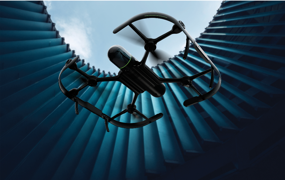
Drones come in all shapes and sizes. What types are used in mining and what are they used for?
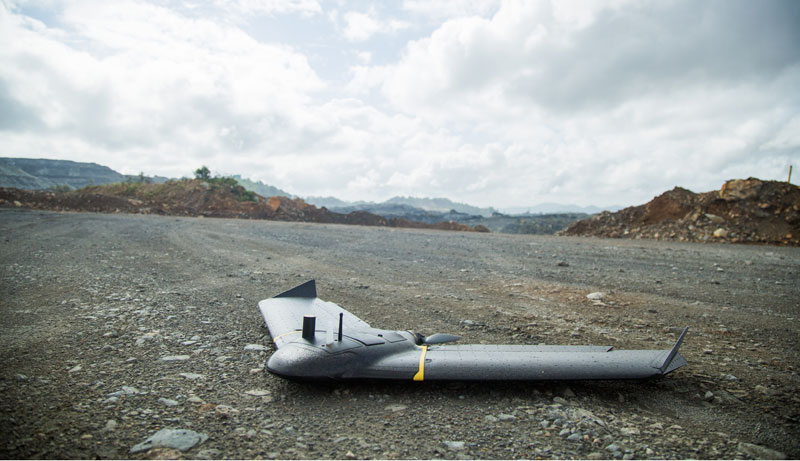
As “bigger is better” remains the mantra regarding mining earthmoving equipment, so too the first drones introduced into mainstream mining were large and heavy, sometimes with more than four rotors. However, the evolution of drones has followed a similar path to technology in general, providing equal if not better results in smaller packages. The standard drones now used at many operations are much smaller and lightweight, have greater connectivity, and often have no assembly or disassembly needed in the field.
What benefits do drones bring to mining operations?
There are unique perspectives that only drones can provide. By accessing this perspective, critical decision-making between engineering, production, maintenance and other departments can be executed in real time. This keeps an operation moving at a faster pace, thus reducing operational delays. Drones have also opened up greater understanding in areas such as precision material placement, stockpile inventories, machine positioning for maintenance outages, ramp and haul road construction, reclamation volumetrics and support, drill and blast audits, safety and operational videos, and many other applications.
You were responsible for implementing and overseeing drone technologies at Navajo mine. Could you explain the practical considerations and challenges when it comes to initiating and operating a drone fleet?
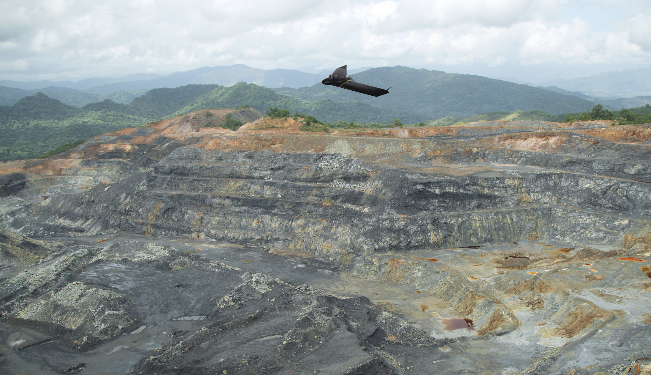
The drone industry is vast and has expanded rapidly and continually since the technology was first accepted into the mining industry. There are now a multitude of options for aerial pictures, video footage, and survey. This includes topographic, thermal, and even vegetation, as well as other advanced LiDAR-based scanning technologies. There are also a variety of advanced drones, which offer options for underground mines for structural inspections, and even underwater survey. Generally, quadcopter drones are better for small pit flights, small aerial surveys, stockpile volumes, and inspections. Alternatively, fixed wing drones have much higher acreage potential and are more suitable for mine-wide flights of reclamation areas and full pit flights.
The processing of the drone data is the next step. If this data is purely pictures and videos, any necessary processing would be very basic. This would include some form of file management and access to ensure production staff can easily view the pictures. This access to media is most beneficial when it includes additional printouts or large TV monitors to cycle through the latest drone images. Touchscreen overlays on TV monitors allow production supervisors and operators to scroll through the latest pit pictures during morning lineout meetings.
If the drone data is more advanced and intended for use with topographic aerial survey and/or stockpile inventory calculations, there are other processing considerations. Depending on the chain of custody and whether a site can contractually process their own stockpile volumes, sites can choose the most beneficial process.
Sites can either contract out both the drone flights and the data processing, fly the areas themselves but have a third-party process the data, or fly the drone and process all data internally. Additionally, depending on whether the survey is for pit volume calculations or stockpile inventories, sites could use a combination of external resources, depending on their own staffing levels.
With these options in mind, the biggest practical consideration and challenge is determining what use of drone technology is the optimal solution for the mine site. Once the optimal solution is determined, the immediate follow-up question is what budget is available for the drone program. With the answer to these two questions in mind, the research into the hardware, software, contractors, and third-party platforms and support can commence.
Are there any health and safety considerations when operating drones over a mine site?
As with any new technology, there are usually health and safety considerations to review. Drone technology is no different. All pilots must have their Part 107 Federal Aviation Administration (FAA) license and adhere to all FAA rules and regulations to ensure their missions are performed safely. Generally, the aerial survey missions and standard pit videos for planning purposes have no interaction with any equipment operators or equipment. Extra precautions might sometimes be taken to alert the equipment operators in the area that drones will be flying overhead, especially if the missions are for videos and cinematic effects.
How do you see the use of drones developing into the future? Are there any functionalities or abilities that you’d like to see on the drones of the future that would further increase their usefulness?
It is very difficult to predict where drone technology will go, within the mining industry, moving forward. There have already been massive improvements in the technical aspects of drones since the mid-2010s. These improvements include:
- Increased flight time between battery changes;
- Operating safely in higher wind speeds;
- Assembly and disassembly improvements;
- Higher video and picture resolution with faster write times;
- Battery charging stations evolving from proprietary pin- type chargers to USB-C universal chargers;
- Faster flight speeds with improvement in acreage covered and radio range; and
- Lighter drone weights and smaller form factors, which resulted in smaller cases and much easier handling.
In addition, data processing is becoming simpler, more user friendly and more widespread, and leaders in third-party processing and cloud computing are emerging.
The future will undoubtedly hold Moore’s Law-style improvements, with costs going down and current functionality increasing. Perhaps lighter-weight LiDAR or new types of photogrammetry will emerge. We might see new FAA regulations allowing first-person view (FPV) drones or even ‘drone in a box’ deployment in the mining industry, with remote drones launched with pre-programmed missions. One thing that is certain: drones are here to stay. The advantages seen at such a disproportionately low cost have allowed drones to firmly plant themselves in the mining industry. Sites without drones will be looking to start a drone program, while sites with a drone program will continue to improve and grow their endeavors. The future is very bright for drones, and it is an exciting time to utilize this technology with mining.
Drone suppliers to the mining industry
As Baucom noted, there are a number of suppliers of drones and supporting services to the mining industry. NAM asked a number of providers a portrait of their services.
AgEagle
Headquartered in Wichita, Kan. – the “Air Capital of the World” – AgEagle Aerial Systems Inc. suppliers advanced drones matched with high-precision sensors and smart, easy-to-used ground control and analytics software. “Drones combine the advantages of highly-accurate manual inspections in mining with the safety, speed, and repeatability of aerial mapping,” explained Gary Licquia, AgEagle’s regional manager – NORAM. “As such, they have been established as multipurpose tools, helping optimize mine management and operations. The onsite use of UAVs in mining remains highly varied. The most common applications are surveying, mapping, exploration, stockpile management, reaching inaccessible areas, waste and water management, and mining environmental protection.”
Ensuring the safety of employees and economic profits has always been a crucial concern in the mining industry. On the gains side, fixed-wing drones, such as AgEagle’s eBee X, allow for capturing onsite data up to 20 times faster than traditional ground-based mining methods. This minimizes business operations downtime in the quarry and reduces insurance costs.
“To be safety-compliant on the mining site, operators should carefully consider the specifications and regulatory status of their chosen drone, opting where possible for a lightweight, robust, and easy-to-use model, such as the eBee X,” continued Licquia. “The lightweight UAV (below 3.5 pounds) is the only drone approved by the U.S. FAA for operations over people: a crucial certification attesting to the safety and reliability of the drone for flying over personnel in the mining site.”
The eBee X supports up to 90 minutes of uninterrupted flight time, offering the potential to cover up to 1,235 acres at a time. In addition, RTK and post-processing ensure high-accuracy surveys (down to 0.6 inches) that are more reliable and cost-effective than terrestrial methods. It can also provide 2D, 3D and thermal data, thanks to its interchangeable cameras.
One application of the eBee X was the mapping of a 790-acre opencast mine in New Caledonia for soil restoration. The project was undertaken by Drones Pacifique Services on behalf of Fonds Nickel, a public body responsible for the rehabilitation of past mining areas on the French overseas territory. Drones Pacifique Services were commissioned to perform several topographical surveys before proceeding with a vegetation plan.
“As with every large and degraded site, this mission in the Thio mining center encountered
a few challenges,” explained Licquia.
The first was the pit’s different bench heights. To overcome this, the Drones Pacifique Services team flew the eBee X three times using eMotion, AgEagle’s flight planning software. “eMotion offers both an elevation data option, which automatically adjusts the flight plan altitude to precisely track terrain with large elevation changes, as well as optimized flight lines orientation to maintain a homogeneous GSD in all the mapped areas,” said Licquia. “This allowed the team to get sharper and more accurate results.”
A second issue was around site security. The sites had been abandoned for some years and access was not easy. However, Drones Pacifique Services were able to launch the drones at a distance of 2 km from the survey site, reducing safety risks to the onsite team. The final concern was the large area to be surveyed, which required a drone capable of extended flight times. “The choice was made to use a fixed-wing because of the advantages of this type of equipment,” said Frédéric Valade, director of Drones Pacifique Services.
During the four flights, a total of 1,531 georeferenced images were collected. Outputs were generated and processed using PIX4Dmapper photogrammetry software (see below) and allowed Fond Nickel to: identify degradation of the slopes due to runoff; carry out in-depth technical studies with good financial forecasts; identify existing vegetation and plan for better revegetation of the sites; and monitor the progress of the work during the implementation phase.
Flyability
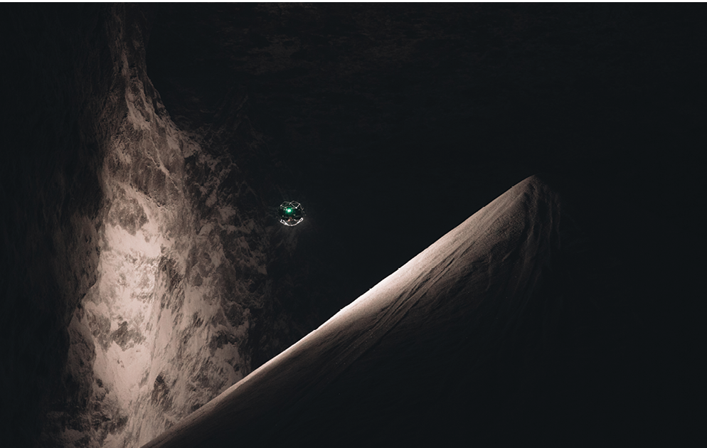
Flyability pioneered confined-space inspection drones, creating new technology that allows inspectors to remotely collect data from inside dangerous confined spaces, instead of in person. Since launching in 2014, the company has become a trusted provider of internal inspection solutions, enabling data collection with cutting-edge hardware and software tools for inspection professionals to help improve safety, reduce downtimes, and cut costs for internal inspections.
Today, Flyability’s drone technology is commonly used in mining operations, allowing mining personnel to collect visual, thermal and LiDAR data from inside dangerous or unstable areas to help plan their operations. The 3D modeling capabilities of Flyability’s Elios 3 drone allow mining operations to conduct stockpile measurements and to better understand the environments in which they’re working. For example, at a major mining operation in Colorado, an Elios 3 drone used to identify the cause of a hangup in an ore pass, after a month of work to unblock the pass had failed.
The blockage was large enough to prevent any ore from falling down the pass. “Often these clogs are found quite close to the truck chute, where the ore exits the raise to be transported by truck to be crushed,” explained Zacc Dukowitz, senior communications manager at Flyability. “But after looking up the raise, personnel in the mine couldn’t see anything in the truck chute. This meant the clog was located somewhere out of sight, farther up the raise.”
To find the clog, personnel started by feeding a cavity monitoring system scanner into the raise through a small access hole in the chute. The scanner’s data provided a low-density point cloud of the raise, which showed the general location of the hangup was about 27.5 meters up the raise. Using this information, the mine exploratory drilled holes from a higher production level into the ore pass and then fed a small, finger-diameter camera into them to try to find the exact location and nature of the clog.
After finding the mass that was believed to be causing the blockage, the mine began efforts to clear it; however, they were repeatedly unsuccessful in doing so. “Despite repeatedly drilling holes to where the hangup was thought to be, dropping small charges into it, and getting small bits of jumbled material to fall out of the bottom of the truck chute, the raise remained clogged,” continued Dukowitz.
These attempts went on for two months, after which this area of the mine was exhausted, and the mine decided to stop working it. The clogged ore pass was thus no longer needed, and the area was abandoned without ever understanding where the clog was or what it looked like. It was only when pilots from Flyability visited the mine to demonstrate the capabilities of the Elios 3 drone that the mystery was cleared up.
“The Elios 3 provides pilots with both a live visual feed and a 3D Live Model on their tablets, allowing them to see what the drone is seeing and to see what the surrounding environment looks like in a 3D model,” said Dukowitz. “Because of these two features, mine personnel believed the drone might be able to provide an answer to the hangup question, and asked if our pilots could fly up the raise.”
Within 10 minutes, geolocational data on the Elios 3’s 3D Live Map showed exactly where the clog was located in the raise. Mine personnel could also see that the hangup was caused by a single, large rock. “This information would have made all the difference to their efforts to unclog the raise,” explained Dukowitz. “Instead of trying to shake the clog loose with several small charges, the mine would have systematically drilled into the rock and loaded a coupled explosive charge into it. If this approach had been taken, the mass could have been fractured into smaller pieces, and the raise could have been cleared.”
Given the success of the Elios 3 at finding the ore pass hangup, mine personnel plan to use it to investigate hangups in the future. They also plan to begin using the Elios 3 for LiDAR and visual data collection in other inaccessible areas throughout the mine. “At the moment, they have identified several scenarios in which the Elios 3 could significantly decrease downtimes and work hours by providing precise data to inform their work, while also increasing safety and the accuracy of the data they collect,” concluded Dukowitz. “As they begin implementation, they also anticipate finding many more use cases for the Elios 3 within their mining operations.”
Hexagon
“Drone flight gives a different view of mining operations that many mines are unable to achieve otherwise,” said Brian Olewinski, senior MinePlan advisor at Hexagon’s Mining division, whose drone offering includes both the drones themselves via subsidiary, Leica Geosystems, and data management software. “With the ability to pull in the point clouds, rotate the view around, and make measurements, mine operators are empowered with a better understanding of the current state of the operation when the drone flight is completed, enabling them to make data-driven decisions efficiently and drive value.”
The Leica BLK2FLY, an autonomous flying laser scanner, is a fully-integrated two-axis LiDAR UAV, capable of measuring complex structures and hard-to-reach places in 3D. The BLK2FLY is part of Hexagon’s fleet of autonomous reality capture sensors, along with BLK2GO (handheld) and BLK ARC (mountable on robotic carriers or, for example, drilling equipment). The design, with a forward-facing LiDAR measuring 420,000 points/sec in a sphere of up to 25 meters, makes BLK sensors the perfect companions for challenging projects.
“The applications of BLK2FLY reach from measuring vertical facades all the way to larger areas and open pits for documentation or further processing such as volumetric analysis,” explained Tobias Pforr, business lead BLK2FLY, Hexagon’s geosystems division. “Thanks to the accuracy of the point cloud, objects such as vegetation can be classified and filtered from a scan, providing an exact digital terrain model (DTM) of the area of interest. Various features, including flying in GNSS-denied areas, are part of the roadmap.”
Geodoc, a surveying expertise company from northern Germany that specializes in underground construction and canals, was asked by a municipality to help localize a defect in one of their sewers.
“Two previous attempts to repair the canal from above had failed as the location was missed, but merging an interior scan, a point cloud and trajectory, with a point cloud from an aerial scan enabled the municipality to localize the defect to within an accuracy of 20 mm and repair it successfully,” said Pforr. “Similar challenges can be seen in other industries, including mining. Particularly in hazardous environments, autonomous reality capture is providing a unique possibility to document and measure complex environments to create exact digital twins. Putting data into context with the help of specialized BLK sensors enables companies to drive their projects more efficiently, save valuable time, and open up new possibilities.”
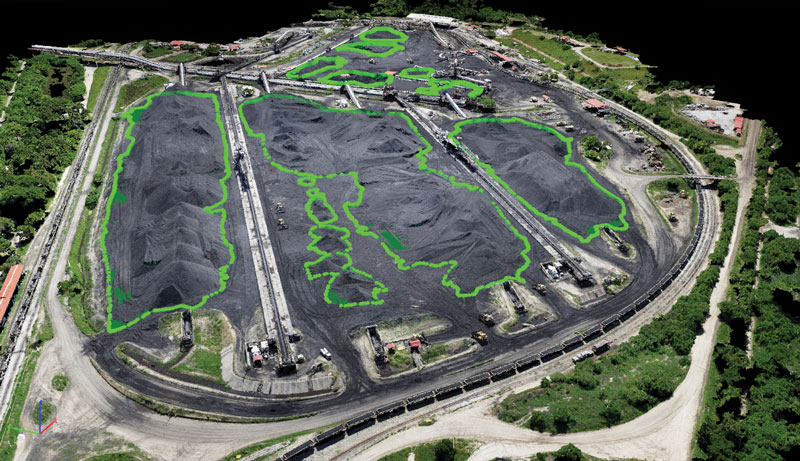
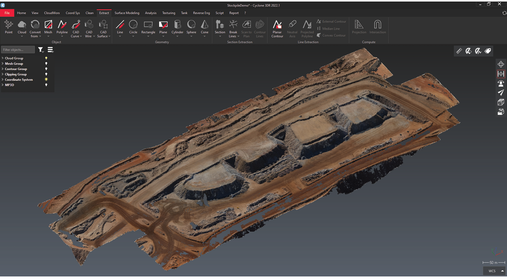
Expanding Hexagon’s drone support offering, the recent integration between the company’s mine planning software HxGN MinePlan and Leica Cyclone 3DR software streamlines mine site data capture for use in downstream processes (Figure 1). Users can load their point cloud into Cyclone 3DR, clean the data and perform tasks such as stockpile volumetrics or surface creation. Users can then seamlessly pull these surfaces into MinePlan 3D to incorporate them into daily planning and engineering workflows.
“The integration of drones has taken a very manual process and streamlined it into a smart, automated process,” continued Olewinski.
“Cyclone 3DR allows for the comparison of surfaces, thus enabling the comparison between as-built versus the design. As a result of this comparison, the user can get a heat map of any overdug or underdug areas. They can even place points and labels noting the distance that underdug areas need to be mined back to achieve design within the software. These surfaces are the starting point of the planning process and have become an integral part of planning workflows.”
Pix4D
Pix4D is a Swiss-based software developer that designs state-of-the-art photogrammetry software. The software uses images captured via drone or mobile devices to define distances, calculate volumes and create terrain models for analysis. Whether it is used for managing stockpiles onsite or tracking changes to a mine site over time, Pix4D has a range of options. Users can choose between the online collaborative platform, PIX4Dcloud or one of Pix4D’s desktop products (PIX4Dmapper, PIX4Dmatic, PIX4Dsurvey).
“There has been a wide range of applications of Pix4D technology in mining around the world,” explained Eloise McMinn Mitchell, content marketing specialist at Pix4D. “For example, it has been used to digitize underground mines, complete stock audits, and enhance site management.”
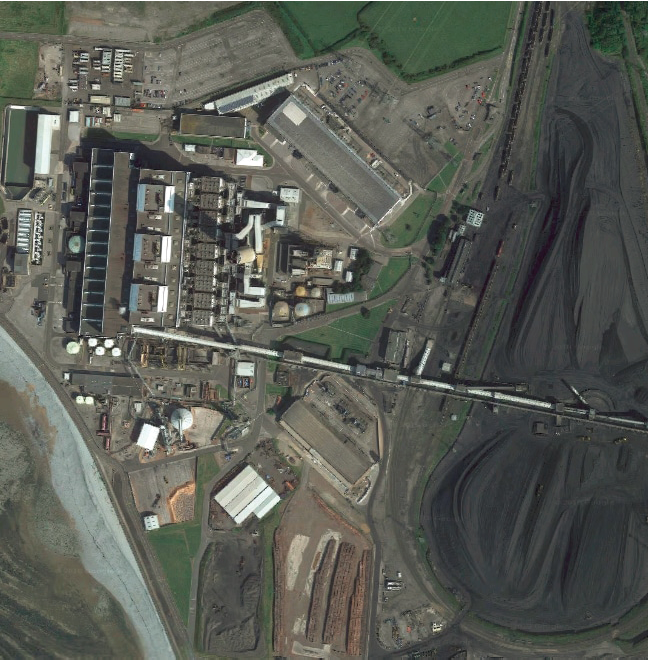
3D maps and models can be created off-site or online, creating minimal disruption to onsite work during data collection and processing. “This enhances the appeal of drones in mining as quick, efficient data collection tools with actionable results,” continued McMinn Mitchell. “The software can also provide elevation profiles and digital surface models among other relevant outputs. It has been put to the test by major corporations, including a drone stock audit of coal piles at Aberthaw coal-fired power plant in the UK with PricewaterhouseCoopers (PwC), which was completed significantly faster thanks to the use of drones and PIX4Dmapper.”
Over the past decade, the UK has been steadily phasing out its coal-fired power plants. Aberthaw in South Wales is among the last (Figure 2). “Run by RWE, one of Europe’s largest energy firms, Aberthaw was the most advanced in the world when it opened in 1960,” explained McMinn Mitchell. “Auditing their stockpiles is an essential part of running the plant, since coal stock has a material value to RWE’s balance sheet.”
The coal piles have traditionally been measured manually, requiring around 1,200 measurements, taken over four hours. This process disrupted work and machinery movement, and placed the person traversing the coal pile at risk. For this audit, however, one of the stockpiles on the 200-hectare site was flown with a fixed-wing PPK drone by QuestUAV. In a PPK (post-processing kinematic) workflow, the drone attaches geocoordinates to each image based on an onboard GNSS receiver. During flight, a base unit also records positional information with more accurate triangulation.
“The drone flight was completed in half an hour – an 85% reduction in time spent – without having to interrupt work elsewhere on the site,” said McMinn Mitchell. “The site team then used PIX4Dmapper photogrammetry software on desktop to interpret the more than 300 images taken at the site. This allowed them to easily recreate the stockpile in 3D, allowing the team to easily measure its volume.”
In parallel to the fixed-wing inspection of the coal pile, a multi-rotor drone was flown over the wider site. The results of this flight helped improve understanding of the landscape around the site, which is important for vegetation management. The project also provided insights of the health and maintenance of other plant assets.
“The Aberthaw project demonstrates the power of drones, plus advanced data processing solutions, to cut time spent on routine processes, such as stockpile measurement, while also reducing health and safety risks,” concluded McMinn Mitchell. “With Pix4D technology, mining professionals can thus enhance their site management and operations.”